-

Death Valley: A Geological Wonder
The national park boasts a surreal landscape unlike any other on earth
It’s all about the geology in Death Valley National Park.
You don’t come to this sprawling desert park for mountain meadows and waves crashing against the shoreline. There are no towering sequoia trees and, except for the occasional flash flood, rushing rivers are in decidedly short supply. But if lacking many of the attractions that visitors commonly associate with more traditional national parks, the very absence of dense forests and thick vegetation leaves the bones of the earth exposed in Death Valley.
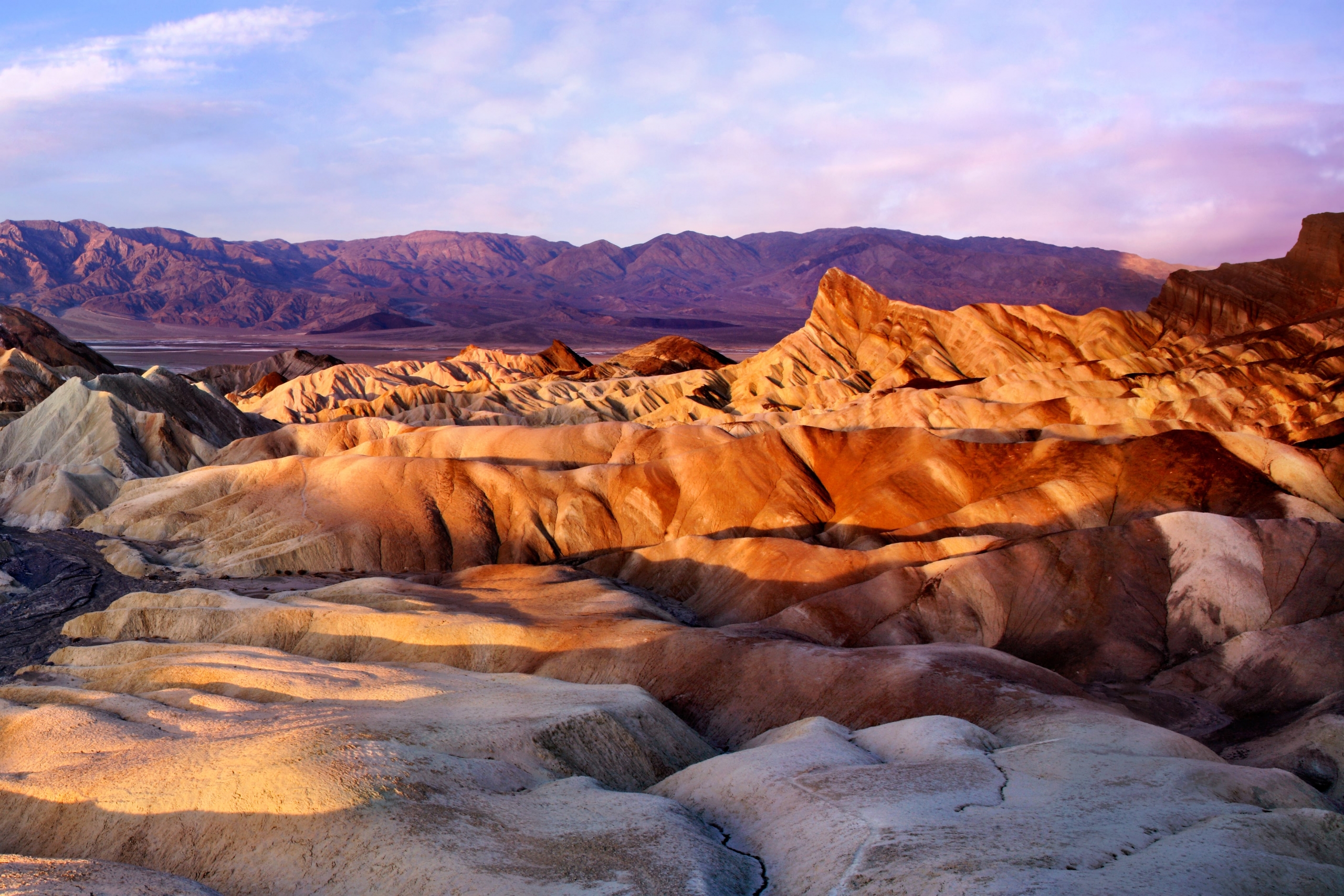
Bare, yes, but hardly boring. With the landscape revealed, you get a much better sense of how erosion and other processes shaped the terrain. There are mud hills, dramatically banded mountain ranges, surreal salt flats, and even volcanic craters. The colors, especially near dawn and sunset, can be absolutely spectacular as the landforms glow with golds, pinks, and purples.
So when it comes to geology, Death Valley definitely rocks. Here’s a quick look at the national park’s top geological attractions. In cooler months, you can also join ranger-led outings that explore the Mesquite Flat Sand Dunes and Golden Canyon.
All of these destinations are easily accessible from your base at The Oasis at Death Valley (previously called Furnace Creek Resort), located in a lush oasis surrounded by the park. It encompasses two hotels — the historic AAA Four Diamond, 66-room Inn at Death Valley (formerly Inn at Furnace Creek) and the family-oriented, 224-room Ranch at Death Valley (formerly Furnace Creek Ranch).
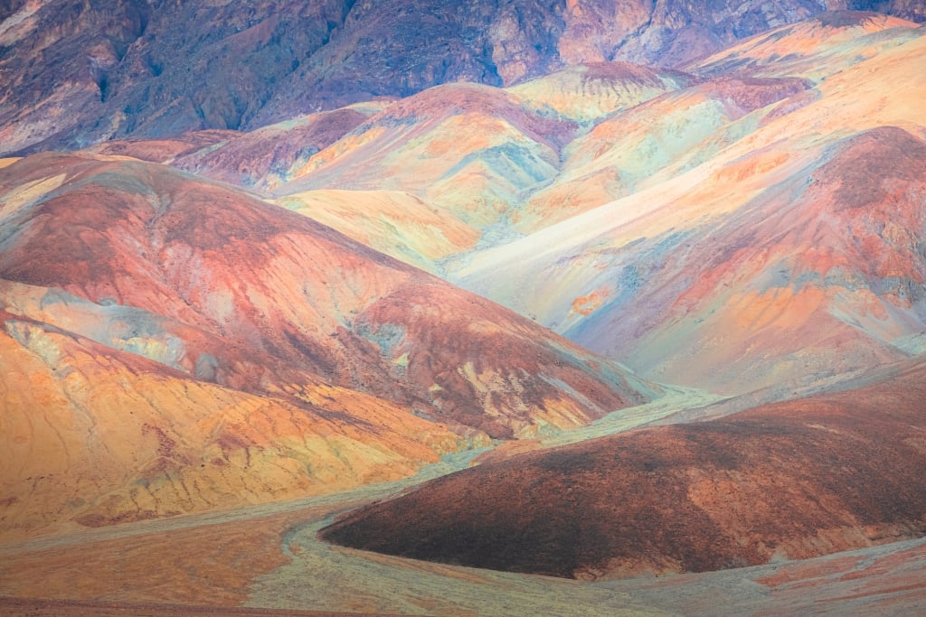
Artist’s Palette
A true natural masterpiece, Artist’s Palette is the most vividly colored formation in the national park. Pinks, greens, and purples splash across the slopes in this section of the Black Mountains.
Accessed off Badwater Road about 10 miles south of The Oasis at Death Valley, the one-way, nine-mile Artist’s Drive weaves and dips through water-carved ravines in the multi-hued badlands that consist of claystones from ancient volcanic ashfalls.
A parking area about halfway along the road overlooks the brilliantly colored Artist’s Palette, the highlight of the drive. The reddish shades are the product of oxidization, while the greens you see come from mica in the rock; manganese created the violet-purple tones.
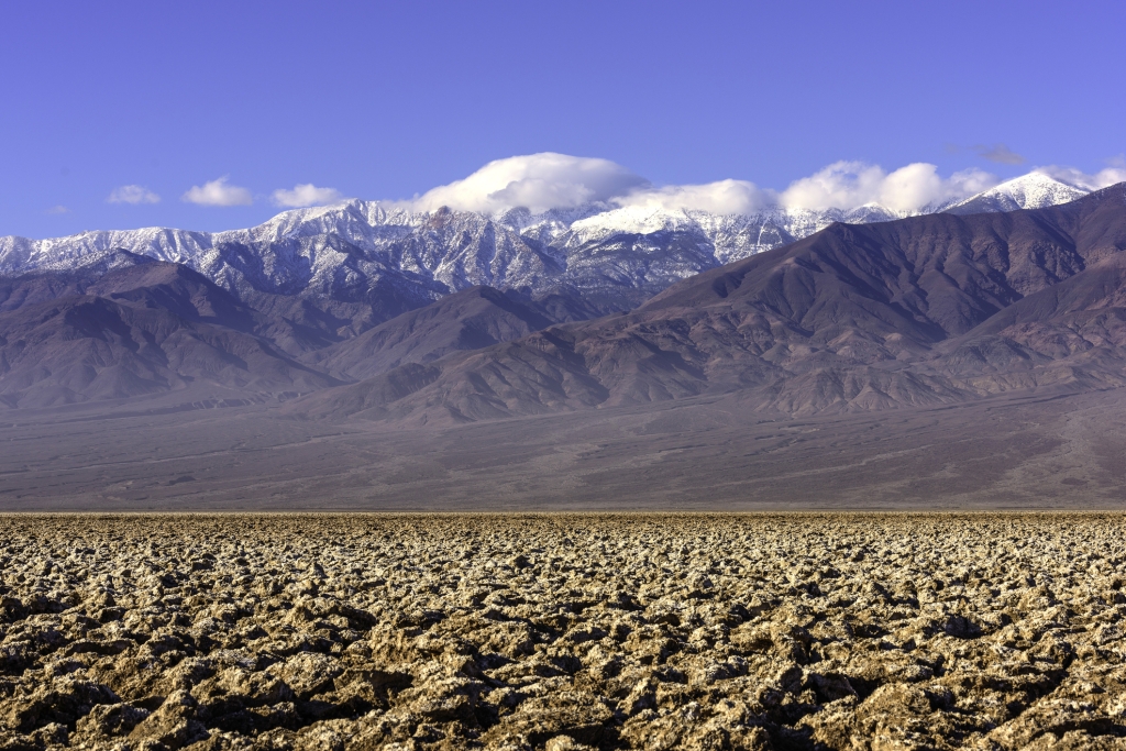
To see the colors at their richest, visit Artist’s Palette late in the afternoon when the sun best illuminates the formations. In places, the drive also looks out to sweeping views of the valley’s 200-square-mile salt flats, the largest protected environment of its kind in the world.
Devil’s Golf Course
About 20 minutes south of The Oasis at Death Valley, via a gravel route off Badwater Road, the Devil’s Golf Course is a huge expanse of jagged, crystallized minerals along the valley floor. As difficult as it is to envision in today’s arid landscape, this area once sat at the bottom of a 30-foot lake. The lake carried dissolved minerals that, as the waters evaporated and receded about 2,000 years ago, became concentrated in smaller pools. In places, a five-foot-deep layer of crystallized salts built up.
Through a process known as capillary action, water bearing salts occasionally rise through the porous crust from the underlying muds, helping the mineral pinnacles grow very slowly — maybe an inch in a few decades. From there, wind and water have sculpted the crystallized formations into an array of fantastic shapes — from delicate arches to tiny turrets that resemble the towers of a castle.
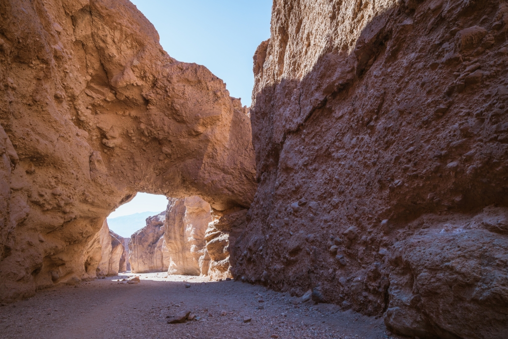
Natural Bridge
An easy, if sandy and rocky, 1-mile round-trip hike leads up a canyon to the largest and best known of the park’s natural bridges.
Carved by sporadic flash floods, the rather literally named Natural Bridge spans a narrow canyon, crossing the gap at a rather sharp, tilted angle. The bridge consists of conglomerate, which is basically a layer of grains, pebbles, and small stones that were long ago deposited in the area, then compressed over time into a bed of rock.
Because it consists of smaller fragments cemented together, conglomerate is softer than such solid rock as granite. As flash floods rushed through the canyon, the tumbling waters undercut the lower layers, carving an opening but leaving this fragile span intact. You can continue past the bridge for roughly another half mile before reaching a dry waterfall.
A gravel route off Badwater Road leads to trailhead parking, which is about 13 ½ miles south of The Oasis at Death Valley.
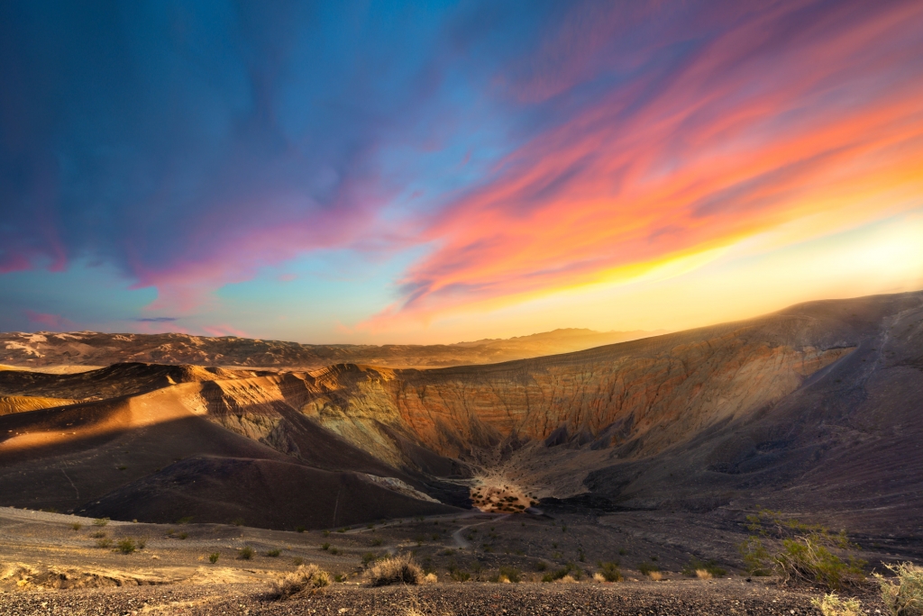
Ubehebe Crater
Take a hike along the rim of a volcanic crater just over an hour northwest of The Oasis at Death Valley.
Six hundred feet deep and a half-mile across, Ubehebe Crater looks like something you might find on the moon. It formed around 2,100 years ago as magma flowing upward from deep within the Earth met pockets of groundwater, setting off a powerful volcanic steam eruption. Lava and rock exploded into the air on this and subsequent eruptions, eventually blanketing an area within 15 miles of the explosions.
At one time the main crater was nearly 800 feet deep, but debris has slowly accumulated and partially refilled it. Ubehebe is the largest of 13 craters in the immediate area, and the 1 ½-mile trail that edges the rim offers spectacular views looking into the maw, as well as panoramas of the surrounding area.
How to Explore
For information and reservations, visit oasisatdeathvalley.com or call 800-236-7916. The Oasis at Death Valley is located just 120 miles northwest of Las Vegas, Nev., and 275 miles northeast of Los Angeles, Calif.